 The Rita Blanca National Grassland is located in the far north of the Texas Panhandle near the town of Texline. It consists of 77,463 acres in Texas and an additional 15,860 acres in Oklahoma. The National Grasslands are under the administration of the United States Department of Agriculture, and are managed by the US Forest Service; the Rita Blanca Grassland is part of the Cibola National Forest headquartered in Albuquerque, New Mexico.
National Grasslands are divided into smaller parcels of land called Units. The Rita Blanca property in Texas is more contiguous than the Oklahoma units, and more contiguous than the Kiowa National Grasslands in New Mexico. But the overall map is still a mix of public and private land, with some grassland units completely surrounded by private property or even inaccessible without crossing private property.
For basic navigation throughout the area and general unit locations, the Forest Service map, Kiowa and Rita Blanca National Grasslands, is sufficient. But if exact navigation is critical, avoiding private property when hunting for instance, there are more detailed topographic quadrangles available. Handouts, brochures, and maps are available at the National Grasslands office in nearby Clayton, New Mexico.

Each of the Units was well marked at a convenient location, normally along a bounding public road. Almost all of the mapped roads, including the two-track ranch roads, were open and vehicle-accessible.

The number of abandoned historic homesteads is fascinating. The land was homesteaded during the period of Western Expansion but many were later abandoned during the Dust Bowl when profitable farming became impossible and families migrated away from the region.

Although many of the grassland units are adjacent to private property, creating the feeling of being on the “back 40” of someone’s ranch rather than in a vast prairie wilderness, there are still open unspoiled vistas and miles of undeveloped land.

The semi-arid shortgrass prairie is home to pronghorn, rabbits, prairie dog colonies, coyotes, and predatory birds.
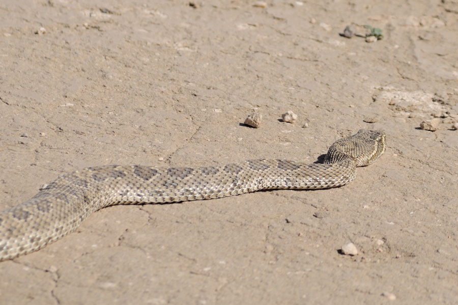
Just a prairie rattler…


I wouldn’t necessarily recommend making a cross-country trip to see the Rita Blanca National Grasslands, but if passing through the area it is absolutely worth a visit. The only location in the Grasslands developed for recreation is the Thompson Grove picnic area Unit 11, where camping is allowed. There is also a notice board at Thompson Grove listing closed hunting areas due to prairie dog colonies and other FYI announcements.
There are no hiking trails, but they generally aren’t needed; prairie walking is easy and navigation in the open land is simple with the aid of windmills and property fences. The two-track ranch roads are suitable for bicycling or even easier walking routes. The Grasslands are leased for ranching so be aware of livestock and always leave gates, open or closed, as you found them.
Are the Rabbit Ear volcanoes (in nearby New Mexico) visible from the Rita Blanca site?
Your information is much appreciated. I have visited nearly half of all the federal land units in the USA (national parks, wildlife refuges, national forest/grasslands, etc). It was difficult to glean from other online reference material that “Thompson Grove picnic area Unit 11” is the only developed area. As you mention, printed material is available in Clayton, but now I do not have to stop there. Thanks.
I too enjoy hiking and photographing while traveling for work. You’ve been to quite a few places that some would call “obscure”! Currently in Amarillo, TX and am considering a visit to Rita Blanca. Just wanted to let you know that your website, scribes, and photos are appreciated! Hope you have many more travels and continue to post them.
Thank you very much for commenting. Please consider writing again after your visit to compare your experience with the generalized description above.